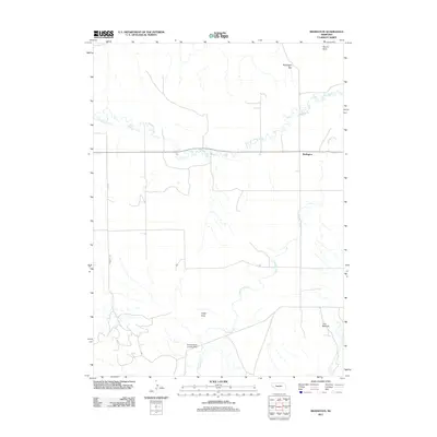
2011 Map of Redington
USGS Topo · Published 2011About this map
Redington serves as the primary focal point of this Nebraska panhandle survey, where the settlement is positioned along the winding course of Pumpkin Creek. The landscape is defined by distinct topographic markers such as Redington Gap and the high point of Round Rock to the north, while the southern reaches are marked by Langs Point and the Twin Mounds. Transportation and utility in this rural corridor are represented by Road 73 and the Schuler-Olsen Landing Strip, indicating the reliance on both traditional road networks and private aviation in this sparsely populated region. The drainage patterns of the Lawrence Fork further characterize the territory, showing how the local hydrology has shaped the ranching and agricultural layout of the area.
Find a feature on this map
9 named features on this map. Tap any name to fly to it.
Don’t see what you’re looking for? This feature index may not catch every label — zoom into the map to look around manually.
Map Details
Editions of this 2011 Redington Map
This is the sole edition of this map. No revisions or reprints were ever made.
Other maps of this area

1898 · Camp Clarke
USGS Topo · 1:125,000

1954 · Scottsbluff
USGS Topo · 1:250,000

1958 · Scottsbluff
USGS Topo · 1:250,000

1965 · Bridgeport NW
USGS Topo · 1:24,000

1965 · South Bayard
USGS Topo · 1:24,000

1965 · McGrew
USGS Topo · 1:24,000

1972 · Horsehead Ranch
USGS Topo · 1:24,000

1973 · Bridgeport SW
USGS Topo · 1:24,000

1973 · Potter 2 NW
USGS Topo · 1:24,000
1973 · Potter 2 NE
USGS Topo · 1:24,000