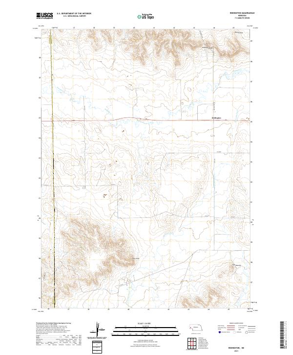
2021 Map of Redington
USGS Topo · Published 2021About this map
Redington stands as a focal point in this section of the Nebraska Panhandle, situated where the high plains break into a complex system of bluffs and drainage basins. The landscape is defined by the eastward flow of Pumpkin Cr and Lawrence Fork, which carve through the terrain beneath prominent landmarks like Redington Gap and Round Rock. This area near the Banner County and Morrill County border shows a transition from flat agricultural tablelands to the more dissected topography of the Wildcat Hills region.
Find a feature on this map
23 named features on this map. Tap any name to fly to it.
Don’t see what you’re looking for? This feature index may not catch every label — zoom into the map to look around manually.
Map Details
Editions of this 2021 Redington Map
This is the sole edition of this map. No revisions or reprints were ever made.
Other maps of this area

1898 · Camp Clarke
USGS Topo · 1:125,000

1954 · Scottsbluff
USGS Topo · 1:250,000

1958 · Scottsbluff
USGS Topo · 1:250,000

1965 · Bridgeport NW
USGS Topo · 1:24,000

1965 · South Bayard
USGS Topo · 1:24,000

1965 · McGrew
USGS Topo · 1:24,000

1972 · Horsehead Ranch
USGS Topo · 1:24,000

1973 · Bridgeport SW
USGS Topo · 1:24,000

1973 · Potter 2 NW
USGS Topo · 1:24,000
1973 · Potter 2 NE
USGS Topo · 1:24,000