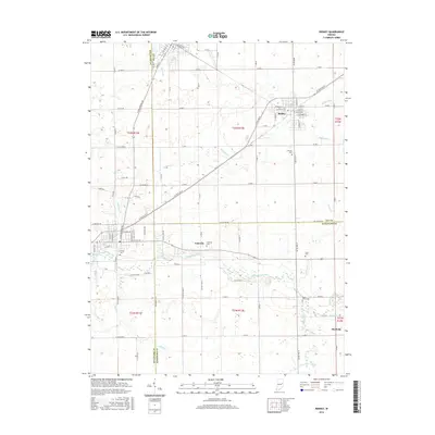
2016 Map of Redkey
USGS Topo · Published 2016About this map
Redkey serves as the primary hub of this eastern Indiana landscape, where the grid of Jay County roads meets the diagonal path of W State Rd 67. The geography is defined by the winding course of the Mississinewa River as it flows westward through the southern half of the quadrangle, passing the settlement of Fairview. Small rural cemeteries, including Hillcrest Cem, Strong Cem, and Caylo Cem, are scattered across the township lines of Delaware, Jay, and Randolph counties, providing vital points of interest for genealogical research in these farming communities. To the southeast, the small settlement of Shedville sits near the confluence of Tough Run and Bush Creek, illustrating the historical reliance on these small waterways. The map reveals a highly structured drainage network, with named features like Rees Ditch and Halfway Creek cutting through the agricultural fields that dominate the terrain.
Find a feature on this map
50 named features on this map. Tap any name to fly to it.
Don’t see what you’re looking for? This feature index may not catch every label — zoom into the map to look around manually.
Map Details
Editions of this 2016 Redkey Map
This is the sole edition of this map. No revisions or reprints were ever made.
Other maps of this area

1952 · Maxville
USGS Topo · 1:24,000

1952 · Muncie East
USGS Topo · 1:24,000

1952 · Farmland
USGS Topo · 1:24,000

1953 · Muncie
USGS Topo · 1:250,000

1956 · Muncie
USGS Topo · 1:250,000

1960 · Pennville
USGS Topo · 1:24,000

1960 · Hartford City East
USGS Topo · 1:24,000

1960 · Blaine
USGS Topo · 1:24,000

1960 · Eaton
USGS Topo · 1:24,000

1960 · Ridgeville
USGS Topo · 1:24,000