
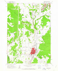
1961 Map of Redmond
USGS Topo · Published 1977About this map
Redmond serves as a central hub for the high desert's agricultural and transit networks in this mid-century survey, revised in the late 1970s. The town's grid is dense with civic landmarks such as Redmond High School and the National Guard Armory, while Roberts Field anchors the southern outskirts. To the north, the smaller settlement of Terrebonne sits near the dramatic canyon of the Crooked River, which carves through the volcanic landscape alongside Smith Rock.
Find a feature on this map
46 named features on this map. Tap any name to fly to it.
Don’t see what you’re looking for? This feature index may not catch every label — zoom into the map to look around manually.
Map Details
Editions of this 1961 Redmond Map
This is the sole edition of this map. No revisions or reprints were ever made.
Other maps of this area

1926 · Bend
USGS Topo · 1:125,000

1929 · Bend
USGS Topo · 1:125,000

1955 · Bend
USGS Topo · 1:250,000

1957 · Bend
USGS Topo · 1:250,000

1958 · Bend
USGS Topo · 1:250,000

1962 · Opal City
USGS Topo · 1:24,000

1962 · Forked Horn Butte
USGS Topo · 1:24,000

1962 · Oneil
USGS Topo · 1:24,000
1962 · Redmond
USGS Topo · 1:24,000
1962 · Cline Falls
USGS Topo · 1:24,000