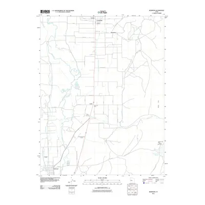
2011 Map of Redmond
USGS Topo · Published 2011About this map
The Sevier River meanders through this agricultural corridor, defining a landscape shaped by a complex network of irrigation works including the West View Canal, Highland Canal, and the South Extension Old Field Canal. This 2011 survey documents the rural communities of Centerfield, Axtell, and Redmond, each anchored by its respective local burial ground such as the Redmond Cemetery. The infrastructure of the Sanpete Valley is evident in the presence of the Salina-Gunnison Airport and specialized rural tracks like Factory Ln and Salt Mine Rd. To the east, the terrain rises toward the White Hills, where the Willow Creek Dam holds the waters of the Willow Creek Reservoir near Niel Spring. The map reflects a deeply settled region where family names persist on local roads like Neilson Ln and Christensen Ln.
Find a feature on this map
57 named features on this map. Tap any name to fly to it.
Don’t see what you’re looking for? This feature index may not catch every label — zoom into the map to look around manually.
Map Details
Editions of this 2011 Redmond Map
This is the sole edition of this map. No revisions or reprints were ever made.
Other maps of this area

1885 · Manti
USGS Topo · 1:250,000

1885 · Fish Lake
USGS Topo · 1:250,000

1895 · Manti
USGS Topo · 1:250,000

1896 · Fish Lake
USGS Topo · 1:250,000

1956 · Salina
USGS Topo · 1:250,000

1956 · Price
USGS Topo · 1:250,000

1960 · Price
USGS Topo · 1:250,000

1960 · Salina
USGS Topo · 1:250,000

1962 · Salina
USGS Topo · 1:250,000

1962 · Price
USGS Topo · 1:250,000