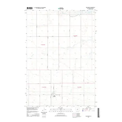
2015 Map of Ree Heights
USGS Topo · Published 2015About this map
Ree Heights serves as the primary settlement hub in this South Dakota landscape, positioned along a structured grid of rural section roads. The town's layout is anchored by N Dakota Ave and Butte Ave, while the nearby Morningside Cem provides a focal point for genealogical interest in Hand County. The surrounding terrain is defined by a network of drainage systems, including the winding paths of Wolf Creek and its smaller tributaries like Little Wolf Cr and Little Turtle Cr. In the northeastern corner, the presence of Lake Louise marks a significant water feature amidst the agricultural expanse. The map illustrates a highly organized township system, with clearly marked boundaries for t112n r70w and t113n r70w, reflecting the persistent influence of the Public Land Survey System on the modern prairie.
Find a feature on this map
27 named features on this map. Tap any name to fly to it.
Don’t see what you’re looking for? This feature index may not catch every label — zoom into the map to look around manually.
Map Details
Editions of this 2015 Ree Heights Map
This is the sole edition of this map. No revisions or reprints were ever made.
Other maps of this area

1949 · Ree Heights NW
USGS Topo · 1:24,000

1950 · Ree Heights SE
USGS Topo · 1:24,000

1950 · Highmore NE
USGS Topo · 1:24,000

1950 · Ree Heights
USGS Topo · 1:24,000

1950 · Highmore SE
USGS Topo · 1:24,000

1951 · Ree Heights NW
USGS Topo · 1:24,000

1951 · Ree Heights NE
USGS Topo · 1:24,000

1953 · Huron
USGS Topo · 1:250,000

1954 · Huron
USGS Topo · 1:250,000

1973 · Macs Corner NE
USGS Topo · 1:24,000