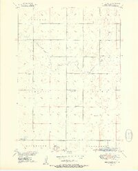
1951 Map of Ree Heights NW
USGS Topo · Published 1951About this map
Lake Louise Recreational Area and Wildlife Refuge anchors the southern portion of this landscape, surrounding the waters of Lake Louise. Mapped by the Geological Survey as part of a Missouri River Basin development program, the area is defined by its rural education network and water sources. Four local schools, including Van Zee Sch, East Campbell Sch, Steptoe Sch, and NE Riverside Sch, are distributed across the townships of Ontario, Fairview, and Campbell, indicating the scattered but organized community structure of the mid-century. Drainage is defined by the winding paths of Lost Creek and Wolf Creek, while several sites marked as Flowing Well suggest the importance of groundwater for agriculture and conservation in this part of Hand County.
Find a feature on this map
18 named features on this map. Tap any name to fly to it.
Don’t see what you’re looking for? This feature index may not catch every label — zoom into the map to look around manually.
Map Details
Editions of this 1951 Ree Heights NW Map
2 editions found
Other maps of this area

1949 · Ree Heights NW
USGS Topo · 1:24,000

1950 · Ree Heights SE
USGS Topo · 1:24,000

1950 · Highmore NE
USGS Topo · 1:24,000

1950 · Ree Heights
USGS Topo · 1:24,000

1950 · Highmore SE
USGS Topo · 1:24,000

1950 · Rezac Lake
USGS Topo · 1:24,000

1951 · Ree Heights NW
USGS Topo · 1:24,000

1951 · Orient SW
USGS Topo · 1:24,000

1951 · Rezac Lake
USGS Topo · 1:24,000

1951 · Polo
USGS Topo · 1:24,000