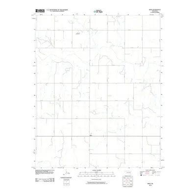
2010 Map of Reed
USGS Topo · Published 2010About this map
Reed serves as the central anchor of this southwestern Oklahoma landscape, positioned at a rural junction where the section-line road network meets. The area is defined by a dendritic drainage pattern of seasonal and perennial waterways that move across the plains, including the winding course of Sleepy John Creek and the headwaters of Sulphur Creek. A notable human modification of this hydrology is seen at the Kenneth Houck Dam, which impounds Deer Creek in the northern portion of the map. The map reflects a classic Great Plains agricultural grid, with named section roads like n1840 RD and e1450 RD providing a precise framework for the ranches and farms of Greer County. Other significant water features such as Station Creek, Smedley Creek, and the southern Mulberry Creek highlight the vital role of water management in this prairie environment.
Find a feature on this map
25 named features on this map. Tap any name to fly to it.
Don’t see what you’re looking for? This feature index may not catch every label — zoom into the map to look around manually.
Map Details
Editions of this 2010 Reed Map
This is the sole edition of this map. No revisions or reprints were ever made.
Other maps of this area

1955 · Lawton
USGS Topo · 1:250,000

1955 · Clinton
USGS Topo · 1:250,000

1957 · Clinton
USGS Topo · 1:250,000

1961 · Willow
USGS Topo · 1:62,500

1961 · Erick
USGS Topo · 1:62,500

1971 · Russell
USGS Topo · 1:24,000

1971 · Mangum North
USGS Topo · 1:24,000

1971 · Vinson
USGS Topo · 1:24,000

1971 · Mangum South
USGS Topo · 1:24,000

1971 · Reed
USGS Topo · 1:24,000