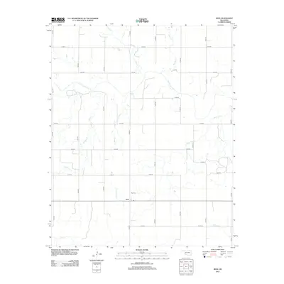
2012 Map of Reed
USGS Topo · Published 2012About this map
Reed stands as the primary settlement in this southwestern Oklahoma landscape, positioned north of Cape Cr in a region defined by a rigid grid of local section roads and winding watercourses. The drainage of the Elm Fork Red River dominates the northern half of the sheet, where several tributaries like Station Cr and Deer Cr converge. For genealogists and local historians, the Reed Cem provides a specific point of interest just north of the town center. The terrain is marked by distinctive natural landmarks such as Jay Buckle Spring and the meandering paths of Sleepy John Cr and Sulphur Cr. This area preserves the spatial layout of an agricultural community at the start of the 2010s, showing the intersection of rural life and the prairie's natural drainage patterns.
Find a feature on this map
27 named features on this map. Tap any name to fly to it.
Don’t see what you’re looking for? This feature index may not catch every label — zoom into the map to look around manually.
Map Details
Editions of this 2012 Reed Map
This is the sole edition of this map. No revisions or reprints were ever made.
Other maps of this area

1955 · Lawton
USGS Topo · 1:250,000

1955 · Clinton
USGS Topo · 1:250,000

1957 · Clinton
USGS Topo · 1:250,000

1961 · Willow
USGS Topo · 1:62,500

1961 · Erick
USGS Topo · 1:62,500

1971 · Russell
USGS Topo · 1:24,000

1971 · Mangum North
USGS Topo · 1:24,000

1971 · Vinson
USGS Topo · 1:24,000

1971 · Mangum South
USGS Topo · 1:24,000

1971 · Reed
USGS Topo · 1:24,000