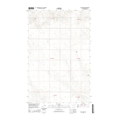
2014 Map of Reed Springs
USGS Topo · Published 2014About this map
Reed Springs and the local drainage system define this high plains landscape in Roosevelt County during the early 21st century. The terrain is characterized by winding seasonal waterways and distinctive geological formations, most notably the prominent Castle Rock situated in the northern section of the quadrangle. The hydrologic network is centered on the meandering path of Boxelder Cr, which cuts through the center of the survey area, joined by the N Fork Tule Cr in the southwest.
Find a feature on this map
15 named features on this map. Tap any name to fly to it.
Don’t see what you’re looking for? This feature index may not catch every label — zoom into the map to look around manually.
Map Details
Editions of this 2014 Reed Springs Map
This is the sole edition of this map. No revisions or reprints were ever made.
Other maps of this area

1910 · Cuskers
USGS Topo · 1:62,500

1915 · Tule Valley
USGS Topo · 1:62,500

1915 · Cuskers
USGS Topo · 1:62,500

1954 · Wolf Point
USGS Topo · 1:250,000

1958 · Wolf Point
USGS Topo · 1:250,000

1973 · Nielsen Coulee
USGS Topo · 1:24,000

1973 · Peerless 4 SE
USGS Topo · 1:24,000

1973 · Peerless 4 SW
USGS Topo · 1:24,000
1983 · Tule Valley East
USGS Topo · 1:24,000
1983 · Tule Valley West
USGS Topo · 1:24,000