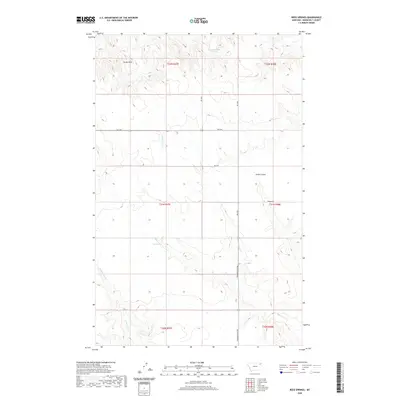
2020 Map of Reed Springs
USGS Topo · Published 2020About this map
Reed Springs and the surrounding drainage basins of Roosevelt County define this stretch of the Montana plains. The landscape is marked by the distinct high point of Castle Rock and the winding course of Smith Coulee, illustrating the natural water-driven topography of the Wolf Point District. Local travel in the late 20th and early 21st centuries relied on a network of rural routes including Powder River Rd and Benrud Rd, which connect the scattered sections of this township-and-range grid.
Find a feature on this map
17 named features on this map. Tap any name to fly to it.
Don’t see what you’re looking for? This feature index may not catch every label — zoom into the map to look around manually.
Map Details
Editions of this 2020 Reed Springs Map
This is the sole edition of this map. No revisions or reprints were ever made.
Other maps of this area

1910 · Cuskers
USGS Topo · 1:62,500

1915 · Tule Valley
USGS Topo · 1:62,500

1915 · Cuskers
USGS Topo · 1:62,500

1954 · Wolf Point
USGS Topo · 1:250,000

1958 · Wolf Point
USGS Topo · 1:250,000

1973 · Nielsen Coulee
USGS Topo · 1:24,000

1973 · Peerless 4 SE
USGS Topo · 1:24,000

1973 · Peerless 4 SW
USGS Topo · 1:24,000
1983 · Tule Valley East
USGS Topo · 1:24,000
1983 · Tule Valley West
USGS Topo · 1:24,000