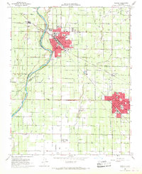
1966 Map of Reedley
USGS Topo · Published 1967About this map
The Kings River defines the western edge of this agricultural landscape, where the neighboring cities of Reedley and Dinuba anchor the central San Joaquin Valley. This mid-1960s survey captures a transition in water management and transport, showing the massive Friant-Kern Aqueduct cutting through a complex network of older irrigation works like the Alta Canal and Traver Creek. The region's commitment to education is evident in the numerous rural schoolhouses and larger institutions such as Reedley College, Immanuel Academy, and the Dinuba Academy. Smaller, specialized settlements like the packing point at Lacjac and the Mennonite-influenced Delft Colony reflect the localized patterns of trade and community that flourished along the Atchison Topeka and Santa Fe Railway and Southern Pacific Railroad lines during this era of peak valley production.
Find a feature on this map
45 named features on this map. Tap any name to fly to it.
Don’t see what you’re looking for? This feature index may not catch every label — zoom into the map to look around manually.
Map Details
Editions of this 1966 Reedley Map
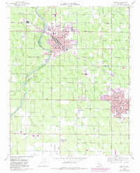
2 editions found
Other maps of this area

1921 · Squaw Valley
USGS Topo · 1:31,680

1922 · Trimmer
USGS Topo · 1:96,000

1923 · Sultana
USGS Topo · 1:31,680

1923 · Wahtoke
USGS Topo · 1:31,680

1923 · Sanger
USGS Topo · 1:31,680

1924 · Reedley
USGS Topo · 1:31,680

1924 · Selma
USGS Topo · 1:31,680

1924 · Citrus Cove
USGS Topo · 1:31,680

1924 · Dinuba
USGS Topo · 1:125,000

1926 · Burris Park
USGS Topo · 1:31,680