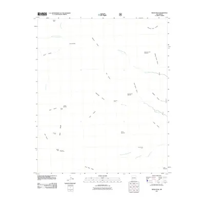
2011 Map of Reeds Peak
USGS Topo · Published 2011About this map
The Black Range dominates this corner of the New Mexico wilderness, defining a landscape carved by a dense network of canyons and high peaks. At the heart of this high-elevation terrain, the Reeds Peak Lookout Tower stands atop Reeds Peak, serving as a critical vantage point for forest management. The map details a scattered history of ranching and early habitation through labels such as Reeds Ranch and Whitmore Cabin, located near the intersection of Black Canyon and Falls Canyon.
Find a feature on this map
38 named features on this map. Tap any name to fly to it.
Don’t see what you’re looking for? This feature index may not catch every label — zoom into the map to look around manually.
Map Details
Editions of this 2011 Reeds Peak Map
This is the sole edition of this map. No revisions or reprints were ever made.
Other maps of this area

1949 · Lookout Mountain
USGS Topo · 1:62,500

1954 · Tularosa
USGS Topo · 1:250,000

1958 · Tularosa
USGS Topo · 1:250,000

1963 · Bonner Canyon
USGS Topo · 1:24,000

1963 · Reeds Peak
USGS Topo · 1:24,000
1963 · Hay Mesa
USGS Topo · 1:24,000

1963 · Sugarloaf Peak
USGS Topo · 1:24,000

1963 · Victoria Park
USGS Topo · 1:24,000

1963 · Apache Peak
USGS Topo · 1:24,000

1965 · Winston
USGS Topo · 1:24,000