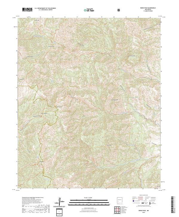
2023 Map of Reeds Peak
USGS Topo · Published 2023About this map
The Continental Divide winds through this high-elevation stretch of the Black Range within the Aldo Leopold Wilderness. This rugged section of the Gila National Forest is defined by a network of steep canyons and prominent summits, including the namesake Reeds Peak and Diamond Peak. The landscape is a vital watershed where numerous springs, such as Newman Spring and Hickland Spring, feed into drainage systems like South Diamond Creek and Cherry Creek. Notable for its lack of modern road infrastructure, the area relies on a system of historical paths including the Continental Divide National Scenic Trl and Circle Seven Trl, reflecting its preserved primitive state. Place names like Spud Patch and Reeds Meadow hint at the localized land use and surveying history of this Sierra County terrain.
Find a feature on this map
58 named features on this map. Tap any name to fly to it.
Don’t see what you’re looking for? This feature index may not catch every label — zoom into the map to look around manually.
Map Details
Editions of this 2023 Reeds Peak Map
This is the sole edition of this map. No revisions or reprints were ever made.
Other maps of this area

1949 · Lookout Mountain
USGS Topo · 1:62,500

1954 · Tularosa
USGS Topo · 1:250,000

1958 · Tularosa
USGS Topo · 1:250,000

1963 · Bonner Canyon
USGS Topo · 1:24,000

1963 · Reeds Peak
USGS Topo · 1:24,000
1963 · Hay Mesa
USGS Topo · 1:24,000

1963 · Sugarloaf Peak
USGS Topo · 1:24,000

1963 · Victoria Park
USGS Topo · 1:24,000

1963 · Apache Peak
USGS Topo · 1:24,000

1965 · Winston
USGS Topo · 1:24,000