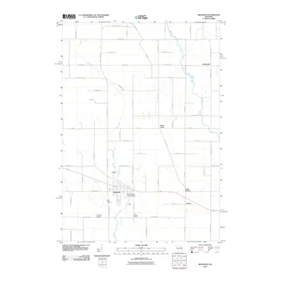
2010 Map of Reedsville
USGS Topo · Published 2010About this map
Reedsville serves as a primary hub in this corner of Brown County, where the landscape is defined by the winding course of Mud Creek and the Branch River. This 2010 survey illustrates a rural region anchored by small settlements like Grimms and Maple Grove, connected by a network of local roads such as Reifs Mills Rd and Taus Rd. For genealogists and local historians, the map is particularly useful for locating several distinct burial grounds that speak to the area's religious heritage, including the Saint John-Saint James Evangelical Lutheran Cemetery near the heart of town and the more outlying Evangelical Immanuel Cemetery. The placement of Menchalville in the northeast and North Grimms to the east shows the persistent footprint of these farming communities and their relationship to the waterways that cross the terrain.
Find a feature on this map
53 named features on this map. Tap any name to fly to it.
Don’t see what you’re looking for? This feature index may not catch every label — zoom into the map to look around manually.
Map Details
Editions of this 2010 Reedsville Map
This is the sole edition of this map. No revisions or reprints were ever made.
Other maps of this area

1954 · De Pere
USGS Topo · 1:62,500

1954 · Denmark
USGS Topo · 1:62,500

1954 · Chilton
USGS Topo · 1:62,500

1954 · Reedsville
USGS Topo · 1:62,500

1954 · Manitowoc
USGS Topo · 1:250,000

1955 · Green Bay
USGS Topo · 1:250,000

1958 · Manitowoc
USGS Topo · 1:250,000

1974 · Brillion
USGS Topo · 1:24,000
1974 · Potter
USGS Topo · 1:24,000

1974 · Greenleaf
USGS Topo · 1:24,000