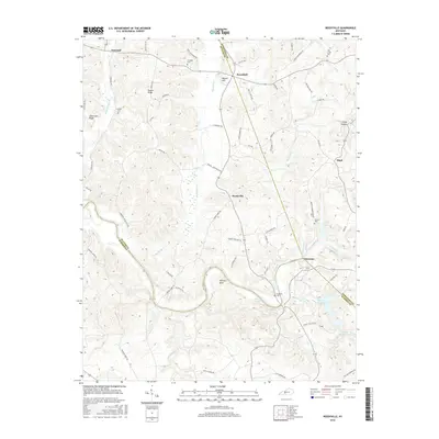
2016 Map of Reedyville
USGS Topo · Published 2016About this map
The Green River carves a deep path through this section of rural Kentucky, forming the prominent Fallover Bend as it winds toward the southwest. This landscape, situated at the meeting point of Butler, Edmonson, and Warren Counties, is defined by its complex drainage network where Big Reedy Cr and Bear Creek flow through deeply incised valleys toward the main river. Small settlements like Reedyville, Roundhill, and Glenmore serve as local anchors for a network of country roads, including the modern paths of KY 185 and KY 70. Genealogists will find significant value in the numerous family and community burial sites scattered across the ridges, such as Threlkel Cem, Cardwell Cem, and Honakers Cem. The southern portion of the quadrangle includes recreational and water features like Shanty Hollow Lake and Raymer Lake, highlighting the area's transition from high ridges like Region Ridge to the low-lying river bottoms.
Find a feature on this map
77 named features on this map. Tap any name to fly to it.
Don’t see what you’re looking for? This feature index may not catch every label — zoom into the map to look around manually.
Map Details
Editions of this 2016 Reedyville Map
This is the sole edition of this map. No revisions or reprints were ever made.
Other maps of this area

1914 · Little Muddy
USGS Topo · 1:62,500

1922 · Leitchfield
USGS Topo · 1:48,000

1922 · Brownsville
USGS Topo · 1:62,500

1923 · Brownsville
USGS Topo · 1:62,500

1925 · Spring Lick
USGS Topo · 1:62,500

1925 · Leitchfield
USGS Topo · 1:62,500

1953 · Ready
USGS Topo · 1:24,000

1953 · Bee Spring
USGS Topo · 1:24,000

1954 · Evansville
USGS Topo · 1:250,000

1954 · Bowling Green North
USGS Topo · 1:24,000