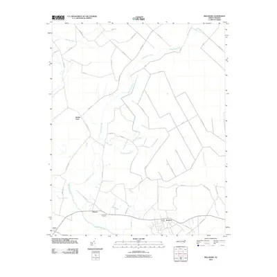
2010 Map of Reelsboro
USGS Topo · Published 2010About this map
Upper Broad Creek winds through a landscape defined by extensive lowlands and small coastal plain settlements in this early 21st-century record. The area is anchored by the community of Reelsboro, situated near the southern edge of the sheet along Neuse Rd. The mapping details a network of named swamps, including Pine Tree Swamp and Savannah Bridge Swamp, which historically influenced the placement of early routes and homesteads. Local history and genealogy interest is concentrated in sites like Sand Hill Cemetery and Hollywood Cemetery.
Find a feature on this map
48 named features on this map. Tap any name to fly to it.
Don’t see what you’re looking for? This feature index may not catch every label — zoom into the map to look around manually.
Map Details
Editions of this 2010 Reelsboro Map
This is the sole edition of this map. No revisions or reprints were ever made.
Other maps of this area

1901 · New Bern
USGS Topo · 1:62,500

1902 · Vanceboro
USGS Topo · 1:62,500

1903 · New Bern
USGS Topo · 1:62,500

1904 · Vanceboro
USGS Topo · 1:62,500

1905 · Vanceboro
USGS Topo · 1:62,500

1950 · New Bern
USGS Topo · 1:24,000

1950 · Aurora
USGS Topo · 1:24,000

1950 · Edward
USGS Topo · 1:24,000

1950 · Upper Broad Creek
USGS Topo · 1:24,000

1950 · Arapahoe
USGS Topo · 1:24,000