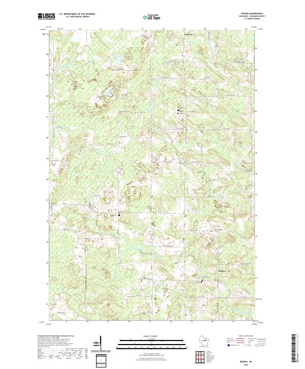
2022 Map of Regina
USGS Topo · Published 2022About this map
The Middle Br Embarrass River and the N Br Embarrass River wind through this section of Shawano County, defining a landscape of low-lying wetlands and scattered small lakes. The small community of Regina serves as a local anchor in the southern portion, while the southern edge of Mattoon is visible at the northern boundary. The area is notable for its concentration of rural burial sites, providing a significant resource for genealogical research. These include the Saint-Pauls Riverside Cem near the riverbanks and the Almon Town Cem. Moving across the township lines of t29n r12e and its neighbors, the map documents a series of family-named landmarks and water bodies like Cranberry Lake and Baker Lake. The road network, including Co Hwy N and various timber lanes, reflects the region's agricultural and logging heritage.
Find a feature on this map
54 named features on this map. Tap any name to fly to it.
Don’t see what you’re looking for? This feature index may not catch every label — zoom into the map to look around manually.
Map Details
Editions of this 2022 Regina Map
This is the sole edition of this map. No revisions or reprints were ever made.
Other maps of this area

1952 · Antigo
USGS Topo · 1:48,000

1952 · White Lake
USGS Topo · 1:48,000

1954 · Wittenberg
USGS Topo · 1:48,000

1954 · Gresham
USGS Topo · 1:48,000

1954 · Iron Mountain
USGS Topo · 1:250,000

1955 · Green Bay
USGS Topo · 1:250,000

1959 · Iron Mountain
USGS Topo · 1:250,000

1964 · Wittenberg
USGS Topo · 1:62,500

1964 · Gresham
USGS Topo · 1:62,500
1973 · Aniwa
USGS Topo · 1:24,000