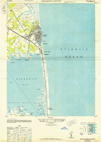
1948 Map of Rehoboth Beach
USGS Topo · Published 1948About this map
Rehoboth Beach and Dewey Beach are captured here as they appeared just after the Second World War, situated between the open Atlantic Ocean and the intricate wetlands of Rehoboth Bay. The coastline at this time is defined by prominent sand dunes and essential maritime infrastructure, including the Rehoboth Beach Coast Guard Sta and the Indian River Inlet Coast Guard Sta. Inland, the Pennsylvania (Delmarva Division) railroad and the Lewes and Rehoboth Canal illustrate the era's vital transportation corridors, linking coastal settlements to the mainland.
Find a feature on this map
66 named features on this map. Tap any name to fly to it.
Don’t see what you’re looking for? This feature index may not catch every label — zoom into the map to look around manually.
Map Details
Editions of this 1948 Rehoboth Beach Map
2 editions found
Other maps of this area

1888 · Cape May
USGS Topo · 1:62,500

1893 · Cape May
USGS Topo · 1:62,500

1898 · Cape May
USGS Topo · 1:62,500

1918 · Rehoboth
USGS Topo · 1:62,500

1918 · Cape Henlopen
USGS Topo · 1:62,500

1918 · Cape May
USGS Topo · 1:62,500

1925 · Cape May
USGS Topo · 1:62,500

1937 · Cape Henlopen
USGS Topo · 1:62,500

1938 · Rehoboth
USGS Topo · 1:62,500
1940 · Cape May
USGS Topo · 1:62,500