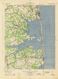
1944 Map of Rehoboth
USGS Topo · Published 1944About this map
The Atlantic coastline of Sussex County is defined here by the intricate branching of Rehoboth Bay and Indian River Bay, captured just before the mid-century surge in coastal development. The landscape is a patchwork of tidal marshes and named necks, such as Indian River Neck and Cedar Neck, where the local economy centered on the water and small rural hubs. Inland, the map reveals a high density of small-scale social infrastructure, including numerous rural schoolhouses like Sunshine Sch and Harmon Sch, alongside landmarks like Grange Hall near Hollyville.
Find a feature on this map
73 named features on this map. Tap any name to fly to it.
Don’t see what you’re looking for? This feature index may not catch every label — zoom into the map to look around manually.
Map Details
Editions of this 1944 Rehoboth Map
This is the sole edition of this map. No revisions or reprints were ever made.
Other maps of this area

1888 · Cape May
USGS Topo · 1:62,500

1893 · Cape May
USGS Topo · 1:62,500

1898 · Cape May
USGS Topo · 1:62,500

1901 · Ocean City
USGS Topo · 1:62,500

1902 · Pittsville
USGS Topo · 1:62,500

1917 · Millsboro
USGS Topo · 1:62,500

1918 · Cedar Creek
USGS Topo · 1:62,500

1918 · Rehoboth
USGS Topo · 1:62,500

1918 · Cape Henlopen
USGS Topo · 1:62,500

1918 · Cape May
USGS Topo · 1:62,500