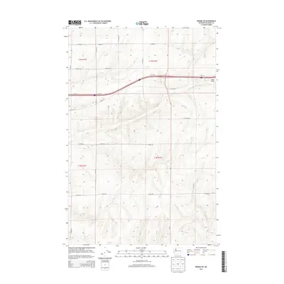
2013 Map of Reiman SW
USGS Topo · Published 2013About this map
Bauer Coulee carves through this portion of the Columbia Plateau in the early 21st century, defining the local drainage and terrain. The landscape is structured by a rigorous grid of section lines and gravel roads, reflecting the large-scale agricultural heritage of the region. Major transportation arteries intersect here, with Interstate 90 running east-west across the northern sections, while Wa-21 provides the primary north-south corridor. Family-named roads such as N Lauer Rd, N Hoffman Rd, and N Jantz Rd reach into the interior sections, providing access to isolated farmsteads and field boundaries. This network, including E Koch Rd and E Harder Rd, illustrates the persistence of the Public Land Survey System in organizing the rural Washington wheat country.
Find a feature on this map
26 named features on this map. Tap any name to fly to it.
Don’t see what you’re looking for? This feature index may not catch every label — zoom into the map to look around manually.
Map Details
Editions of this 2013 Reiman SW Map
This is the sole edition of this map. No revisions or reprints were ever made.
Other maps of this area

1916 · Connell
USGS Topo · 1:125,000

1918 · Connell
USGS Topo · 1:125,000

1925 · Schrag
USGS Topo · 1:62,500

1953 · Walla Walla
USGS Topo · 1:250,000

1953 · Ritzville
USGS Topo · 1:250,000

1958 · Walla Walla
USGS Topo · 1:250,000

1959 · Ritzville
USGS Topo · 1:250,000

1965 · Ritzville
USGS Topo · 1:250,000

1967 · Reiman SW
USGS Topo · 1:24,000

1967 · Schoonover
USGS Topo · 1:24,000