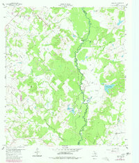
1959 Map of Reliance
USGS Topo · Published 1980About this map
The Navasota River carves a winding path through this landscape, serving as the natural boundary between Brazos and Grimes counties. This mid-century survey reveals a predominantly rural and riparian environment, defined by complex water features like Fishhole Slough, Big Slough, and Flat Pond. The small community of Reliance is the primary settlement, while the presence of Martin Prairie Ch and Stick Cem provides essential reference points for genealogists researching family ties in this river-bottom region.
Find a feature on this map
24 named features on this map. Tap any name to fly to it.
Don’t see what you’re looking for? This feature index may not catch every label — zoom into the map to look around manually.
Map Details
Editions of this 1959 Reliance Map
4 editions found
Other maps of this area

1931 · Iola
USGS Topo · 1:62,500

1954 · Austin
USGS Topo · 1:250,000

1956 · Bryan
USGS Topo · 1:62,500

1956 · Carlos
USGS Topo · 1:62,500

1959 · Clear Lake
USGS Topo · 1:24,000

1959 · Reliance
USGS Topo · 1:24,000

1959 · Ferguson Crossing
USGS Topo · 1:24,000

1960 · Carlos
USGS Topo · 1:24,000

1961 · Wellborn
USGS Topo · 1:24,000

1962 · Keith
USGS Topo · 1:24,000