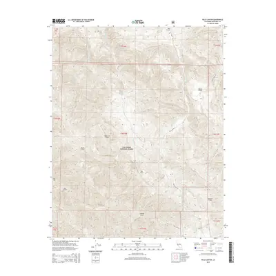
2015 Map of Reliz Canyon
USGS Topo · Published 2015About this map
The Santa Lucia Range dominates this portion of Los Padres National Forest, where steep canyons and high ridges define the central California landscape. This 2015 topography shows a complex drainage network feeding into Reliz Cr, with numerous seasonal tributaries like Vaqueros Cr and Sweetwater Cr cutting through the terrain. Human activity is largely confined to the winding paths of Reliz Canyon Rd and Monroe Canyon Rd, which follow the natural contours of the land. Distinctive geological and topographic features such as The Rocks and Bear Mtn serve as prominent landmarks for navigation in the backcountry. The map also delineates several significant drainages, including Horse Canyon, Thompson Canyon, and Coleman Canyon, illustrating the erosional patterns of the Coast Ranges.
Find a feature on this map
25 named features on this map. Tap any name to fly to it.
Don’t see what you’re looking for? This feature index may not catch every label — zoom into the map to look around manually.
Map Details
Editions of this 2015 Reliz Canyon Map
This is the sole edition of this map. No revisions or reprints were ever made.
Other maps of this area

1912 · Metz
USGS Topo · 1:31,680

1915 · Soledad
USGS Topo · 1:62,500

1919 · King City
USGS Topo · 1:62,500

1919 · Junipero Serra
USGS Topo · 1:62,500

1921 · Metz
USGS Topo · 1:62,500

1939 · King City
USGS Topo · 1:62,500

1940 · Metz
USGS Topo · 1:62,500

1940 · Soledad
USGS Topo · 1:62,500

1941 · Junipero Serra
USGS Topo · 1:62,500

1947 · Metz
USGS Topo · 1:62,500