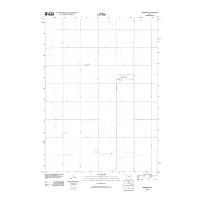
2010 Map of Rembrandt
USGS Topo · Published 2010About this map
Rembrandt serves as the central hub of this agricultural landscape in Buena Vista County, centered around its local services like the Rembrandt Post Office. The township layout is defined by a precise grid of roads including 90th Ave and 450th St, which facilitate the movement of goods and people across the Iowa plains. Natural drainage is provided by several named water bodies that break the symmetry of the farm plots, including Fox Run, Soldier Creek, and the water body known simply as Peach. For genealogists and local historians, the Little Sioux Valley Cemetery stands as a significant landmark for tracing early families who settled this region. The infrastructure is anchored by Hwy 10, illustrating the connection between this rural community and the broader regional transportation network at the turn of the decade.
Find a feature on this map
22 named features on this map. Tap any name to fly to it.
Don’t see what you’re looking for? This feature index may not catch every label — zoom into the map to look around manually.
Map Details
Editions of this 2010 Rembrandt Map
This is the sole edition of this map. No revisions or reprints were ever made.
Other maps of this area

1954 · Fort Dodge
USGS Topo · 1:250,000

1957 · Fort Dodge
USGS Topo · 1:250,000

1958 · Fort Dodge
USGS Topo · 1:250,000

1971 · Sioux Rapids SE
USGS Topo · 1:24,000

1971 · Rembrandt
USGS Topo · 1:24,000

1971 · Sioux Rapids
USGS Topo · 1:24,000

1971 · Peterson SE
USGS Topo · 1:24,000
1971 · Peterson
USGS Topo · 1:24,000

1971 · Webb
USGS Topo · 1:24,000

1979 · Storm Lake
USGS Topo · 1:24,000