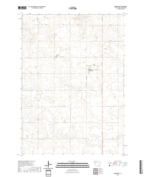
2022 Map of Rembrandt
USGS Topo · Published 2022About this map
Rembrandt serves as the central hub of this agricultural landscape in Buena Vista County, organized by a precise grid of rural roads and section lines. The town's layout is clearly defined along 475th St and 480th St, showing the concentration of modern residential and civic structures in an otherwise expansive farming region. Just to the northwest of the town center, the Little Sioux Valley Cem provides a significant touchstone for local genealogical research, marking the history of early families who settled this prairie. The terrain is gently shaped by the winding path of Soldier Cr as it cuts through the northeastern sections, creating the primary natural drainage for the surrounding fields. Large-scale infrastructure, including major county routes like Co Hwy M44 and Co Hwy M36, illustrates the modern logistical network required to support the local grain economy.
Find a feature on this map
24 named features on this map. Tap any name to fly to it.
Don’t see what you’re looking for? This feature index may not catch every label — zoom into the map to look around manually.
Map Details
Editions of this 2022 Rembrandt Map
This is the sole edition of this map. No revisions or reprints were ever made.
Other maps of this area

1954 · Fort Dodge
USGS Topo · 1:250,000

1957 · Fort Dodge
USGS Topo · 1:250,000

1958 · Fort Dodge
USGS Topo · 1:250,000

1971 · Sioux Rapids SE
USGS Topo · 1:24,000

1971 · Rembrandt
USGS Topo · 1:24,000

1971 · Sioux Rapids
USGS Topo · 1:24,000

1971 · Peterson SE
USGS Topo · 1:24,000
1971 · Peterson
USGS Topo · 1:24,000

1971 · Webb
USGS Topo · 1:24,000

1979 · Storm Lake
USGS Topo · 1:24,000