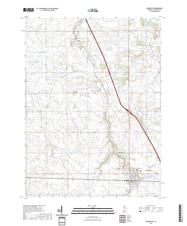
2022 Map of Remington
USGS Topo · Published 2022About this map
Remington anchors the southeastern corner of this Jasper County landscape, where the grid of the town site meets the diagonal path of the interstate. The surrounding terrain is a complex network of managed waterways, including the Carpenter Cr and numerous drainage systems such as the Claude May Ditch, Bice Ditch, and Gushwa Ditch. These features illustrate the intensive agricultural engineering required to manage the prairie lands of northern Indiana. Several distinct settlements and community points are noted outside the main town, including Fountain Park and the small locale of Egypt to the north. Local history is well-preserved through several established burial grounds, notably the Remington Cem, the Sacred Heart Cem, and the more isolated Welsh Cem located near the headwaters of the ditches.
Find a feature on this map
39 named features on this map. Tap any name to fly to it.
Don’t see what you’re looking for? This feature index may not catch every label — zoom into the map to look around manually.
Map Details
Editions of this 2022 Remington Map
This is the sole edition of this map. No revisions or reprints were ever made.
Other maps of this area

1953 · Danville
USGS Topo · 1:250,000

1955 · Danville
USGS Topo · 1:250,000

1956 · Danville
USGS Topo · 1:250,000

1961 · Mount Ayr
USGS Topo · 1:24,000

1962 · Mount Gilboa
USGS Topo · 1:24,000

1962 · Wadena
USGS Topo · 1:24,000

1962 · Templeton NE
USGS Topo · 1:24,000

1962 · Goodland
USGS Topo · 1:24,000
1962 · Mc Coysburg
USGS Topo · 1:24,000
1962 · Rensselaer
USGS Topo · 1:24,000