
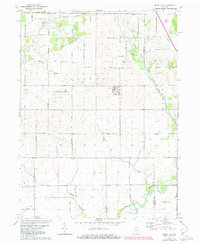
1961 Map of Mount Ayr
USGS Topo · Published 1964About this map
Mount Ayr serves as the central hub of this agricultural landscape in Newton County, where the transition from prairie to managed farmland is marked by an extensive network of drainage projects. The presence of Deardurff Ditch, Lintner Ditch, and Battleday Ditch illustrates the early 1960s efforts to reclaim and maintain the low-lying terrain for cultivation. In the northeast, the Old Railroad Grade follows a north-south path, indicating a shift in transportation infrastructure as rail lines were replaced by the grid of county roads like East Division Road.
Find a feature on this map
36 named features on this map. Tap any name to fly to it.
Don’t see what you’re looking for? This feature index may not catch every label — zoom into the map to look around manually.
Map Details
Editions of this 1961 Mount Ayr Map
2 editions found
Other maps of this area

1953 · Chicago
USGS Topo · 1:250,000

1953 · Danville
USGS Topo · 1:250,000

1955 · Danville
USGS Topo · 1:250,000

1956 · Danville
USGS Topo · 1:250,000

1957 · Chicago
USGS Topo · 1:250,000

1961 · Kentland
USGS Topo · 1:24,000

1961 · Morocco
USGS Topo · 1:24,000

1962 · Parr
USGS Topo · 1:24,000

1962 · Goodland
USGS Topo · 1:24,000
1962 · Fair Oaks
USGS Topo · 1:24,000