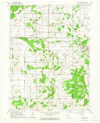
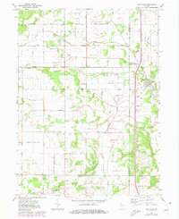
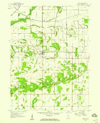
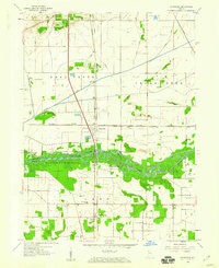
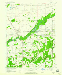
1962 Map of Fair Oaks
USGS Topo · Published 1964About this map
Fair Oaks serves as the primary hub of activity in this rural landscape at the border of Jasper and Newton counties. The settlement is positioned along the Monon Railroad, which cuts diagonally through the eastern half of the terrain, providing a critical transportation link for the surrounding agricultural community. The landscape is defined by an extensive and intricate network of man-made drainage systems, including the Knight Ditch, Wentworth Ditch, and Moffitt Ditch, which converted former wetlands like Mud Lake into productive farmland.
Find a feature on this map
24 named features on this map. Tap any name to fly to it.
Don’t see what you’re looking for? This feature index may not catch every label — zoom into the map to look around manually.
Map Details
Editions of this 1962 Fair Oaks Map
2 editions found
Other maps of this area

1953 · Chicago
USGS Topo · 1:250,000

1953 · Danville
USGS Topo · 1:250,000

1955 · Danville
USGS Topo · 1:250,000

1956 · Danville
USGS Topo · 1:250,000

1957 · Chicago
USGS Topo · 1:250,000
1957 · DeMotte
USGS Topo · 1:24,000
1959 · Schneider
USGS Topo · 1:24,000
1959 · Shelby
USGS Topo · 1:24,000
1961 · Mount Ayr
USGS Topo · 1:24,000
1961 · Morocco
USGS Topo · 1:24,000