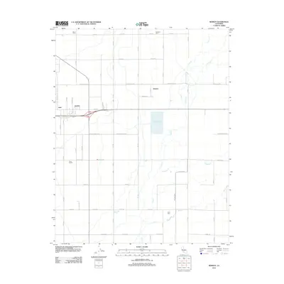
2012 Map of Remnoy
USGS Topo · Published 2012About this map
Remnoy and the neighboring settlements of Hamblin and Shell anchor this agricultural landscape in Kings County. The map reveals a highly structured environment defined by a rigid grid of avenues and roads, reflecting the region's intensive irrigation-based economy. Water management is central to the terrain, as seen in the presence of the Highline Canal and the natural drainage of Cross Cr, Mosquito Cr, and Guernsey Slough.
Find a feature on this map
40 named features on this map. Tap any name to fly to it.
Don’t see what you’re looking for? This feature index may not catch every label — zoom into the map to look around manually.
Map Details
Editions of this 2012 Remnoy Map
This is the sole edition of this map. No revisions or reprints were ever made.
Other maps of this area

1926 · Goshen
USGS Topo · 1:31,680

1926 · Hanford
USGS Topo · 1:31,680

1926 · Burris Park
USGS Topo · 1:31,680

1927 · Traver
USGS Topo · 1:31,680

1927 · Laton
USGS Topo · 1:31,680

1927 · Remnoy
USGS Topo · 1:31,680

1927 · Paige
USGS Topo · 1:31,680

1928 · Waukena
USGS Topo · 1:31,680

1929 · Guernsey
USGS Topo · 1:31,680
1942 · Corcoran
USGS Topo · 1:62,500