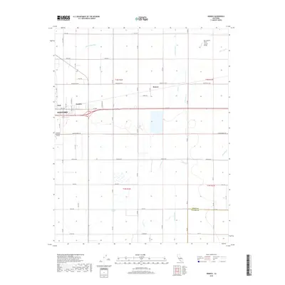
2018 Map of Remnoy
USGS Topo · Published 2018About this map
Hanford anchors this portion of the San Joaquin Valley, where the urban grid of the city meets an extensive agricultural irrigation network. This 2018 survey reveals a landscape defined by water management, featuring a dense system of canals and natural waterways such as the Lakeland Canal, Highline Canal, and the meandering path of Cross Cr. The transition from city streets to rural range is marked by small settlements like Hamblin and Shell, as well as the Hanford Municipal Airport situated just south of the primary east-west corridor of Hanford Armona Rd.
Find a feature on this map
32 named features on this map. Tap any name to fly to it.
Don’t see what you’re looking for? This feature index may not catch every label — zoom into the map to look around manually.
Map Details
Editions of this 2018 Remnoy Map
This is the sole edition of this map. No revisions or reprints were ever made.
Other maps of this area

1926 · Goshen
USGS Topo · 1:31,680

1926 · Hanford
USGS Topo · 1:31,680

1926 · Burris Park
USGS Topo · 1:31,680

1927 · Traver
USGS Topo · 1:31,680

1927 · Laton
USGS Topo · 1:31,680

1927 · Remnoy
USGS Topo · 1:31,680

1927 · Paige
USGS Topo · 1:31,680

1928 · Waukena
USGS Topo · 1:31,680

1929 · Guernsey
USGS Topo · 1:31,680
1942 · Corcoran
USGS Topo · 1:62,500