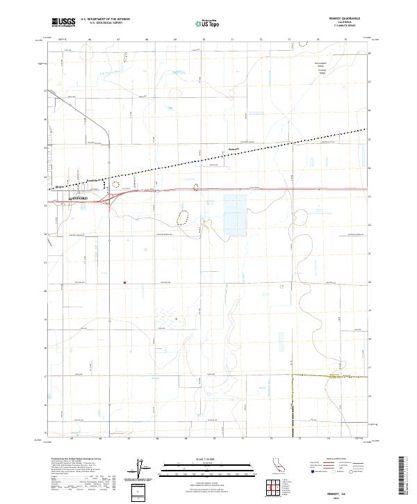
2021 Map of Remnoy
USGS Topo · Published 2021About this map
Agricultural development in the San Joaquin Valley is the defining characteristic of this landscape east of Hanford. The terrain is crisscrossed by an intricate network of irrigation infrastructure essential to the Central Valley economy, including the Lakeland Canal, Highline Canal, and the E Br Peoples Ditch. These man-made waterways intermingle with natural drainages like Guernsey Slough, Cross Creek, and Mill Creek, reflecting the complex water management required for regional farming.
Find a feature on this map
48 named features on this map. Tap any name to fly to it.
Don’t see what you’re looking for? This feature index may not catch every label — zoom into the map to look around manually.
Map Details
Editions of this 2021 Remnoy Map
This is the sole edition of this map. No revisions or reprints were ever made.
Other maps of this area

1926 · Goshen
USGS Topo · 1:31,680

1926 · Hanford
USGS Topo · 1:31,680

1926 · Burris Park
USGS Topo · 1:31,680

1927 · Traver
USGS Topo · 1:31,680

1927 · Laton
USGS Topo · 1:31,680

1927 · Remnoy
USGS Topo · 1:31,680

1927 · Paige
USGS Topo · 1:31,680

1928 · Waukena
USGS Topo · 1:31,680

1929 · Guernsey
USGS Topo · 1:31,680
1942 · Corcoran
USGS Topo · 1:62,500