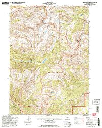
1996 Map of Rendezvous Peak
USGS Topo · Published 1998About this map
Rendezvous Peak and the high ridges of the Teton Range dominate this 1990s landscape, where complex management boundaries intersect across the Continental Divide. The map documents a convergence of protected lands, including Grand Teton National Park, the Jedediah Smith Wilderness, and the Targhee National Forest. Evidence of early resource exploration is found at the Taylor Prospect near Taylor Basin, while a remote Patrol Cabin serves as a lone marker of human infrastructure in the backcountry. A network of high-elevation routes, such as the Teton Crest Trail and Rendezvous Trail, connects vital water sources like Moose Lake and Marion Lake. The topography is defined by significant summits including Housetop Mountain and Mount Glory, reflecting the region's importance for both conservation and alpine recreation before the turn of the twenty-first century.
Find a feature on this map
43 named features on this map. Tap any name to fly to it.
Don’t see what you’re looking for? This feature index may not catch every label — zoom into the map to look around manually.
Map Details
Editions of this 1996 Rendezvous Peak Map
2 editions found
Other maps of this area

1899 · Grand Teton
USGS Topo · 1:125,000

1901 · Grand Teton
USGS Topo · 1:125,000

1931 · Jackson
USGS Topo · 1:125,000

1932 · Irwin
USGS Topo · 1:96,000

1935 · Irwin
USGS Topo · 1:125,000

1935 · Jackson
USGS Topo · 1:125,000

1943 · Driggs
USGS Topo · 1:62,500

1946 · Driggs
USGS Topo · 1:62,500

1955 · Driggs
USGS Topo · 1:250,000

1958 · Driggs
USGS Topo · 1:250,000