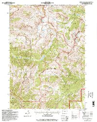
1996 Map of Rendezvous Peak
USGS Topo · Published 1998About this map
Rendezvous Peak and the high ridges of the Teton Range dominate this mid-1990s survey, illustrating a landscape defined by strict conservation boundaries and alpine recreation. The map captures the meeting point of Grand Teton National Park, the Targhee National Forest, and the Jedediah Smith Wilderness, showing how land management has shaped the territory around Mount Glory. Evidence of the region’s earlier era remains at a prospect near Taylor Basin, while the modern character is reflected in the extensive trail network, including the Teton Crest Trail and Game Creek Trail. At the foot of Phillips Ridge, the settlement of Wilson represents the interface between these protected wildlands and the expanding valley communities. Notable hydrological and topographical landmarks like Ski Lake, the Glory Slide, and the remote Patrol Cabin are documented alongside complex drainage systems like Moose Creek and Granite Creek.
Find a feature on this map
38 named features on this map. Tap any name to fly to it.
Don’t see what you’re looking for? This feature index may not catch every label — zoom into the map to look around manually.
Map Details
Editions of this 1996 Rendezvous Peak Map
2 editions found
Other maps of this area

1899 · Grand Teton
USGS Topo · 1:125,000

1901 · Grand Teton
USGS Topo · 1:125,000

1931 · Jackson
USGS Topo · 1:125,000

1932 · Irwin
USGS Topo · 1:96,000

1935 · Irwin
USGS Topo · 1:125,000

1935 · Jackson
USGS Topo · 1:125,000

1943 · Driggs
USGS Topo · 1:62,500

1946 · Driggs
USGS Topo · 1:62,500

1955 · Driggs
USGS Topo · 1:250,000

1958 · Driggs
USGS Topo · 1:250,000