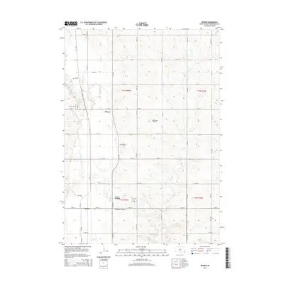
2015 Map of Renner
USGS Topo · Published 2015About this map
The Coteau des Prairies plateau defines the undulating landscape north of Sioux Falls, where the Big Sioux River meanders south toward Mapleton. This 2015 survey shows a rural environment transitioning toward suburban growth, particularly around Renner and Renner Corner. The presence of Sorum Heights and developments like Theresa Cir indicate modern residential expansion alongside traditional landmarks such as Pioneer Cem and the small settlement of Midway. Water management is a visible priority here, evidenced by the Old Diversion Ditch and its proximity to N Ditch Rd, which parallel the river's path. Small tributaries like Silver Cr and Slip-up Cr provide drainage across the township's section-line road grid, linking family properties and agricultural tracts to the larger regional watershed.
Find a feature on this map
41 named features on this map. Tap any name to fly to it.
Don’t see what you’re looking for? This feature index may not catch every label — zoom into the map to look around manually.
Map Details
Editions of this 2015 Renner Map
This is the sole edition of this map. No revisions or reprints were ever made.
Other maps of this area

1955 · Sioux Falls
USGS Topo · 1:250,000

1958 · Sioux Falls
USGS Topo · 1:250,000

1962 · Colton SE
USGS Topo · 1:24,000

1962 · Dell Rapids
USGS Topo · 1:24,000

1962 · Renner
USGS Topo · 1:24,000

1962 · Brandon
USGS Topo · 1:24,000

1962 · Sioux Falls East
USGS Topo · 1:24,000

1962 · Garretson West
USGS Topo · 1:24,000

1962 · Sioux Falls West
USGS Topo · 1:24,000

1962 · Crooks
USGS Topo · 1:24,000