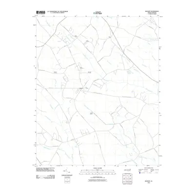
2010 Map of Rennert
USGS Topo · Published 2010About this map
The settlement of Rennert anchors this Robeson County landscape, where the coastal plain’s drainage patterns dictate the placement of roads and homesteads. Broad, winding watercourses such as Big Marsh Swamp and Tenmile Swamp dominate the topography, often flanked by local farm-to-market routes like McGoogan Farm Rd and W Great Marsh Church Rd. This 2010 survey is particularly useful for genealogical research, as it identifies several small, family-associated burial grounds scattered across the countryside, including the Collins Cemetery, Condly Cemetery, and McKinsey Cemetery.
Find a feature on this map
67 named features on this map. Tap any name to fly to it.
Don’t see what you’re looking for? This feature index may not catch every label — zoom into the map to look around manually.
Map Details
Editions of this 2010 Rennert Map
This is the sole edition of this map. No revisions or reprints were ever made.
Other maps of this area

1953 · Florence
USGS Topo · 1:250,000

1954 · Florence
USGS Topo · 1:250,000

1957 · Bladenboro
USGS Topo · 1:62,500

1959 · Saint Pauls
USGS Topo · 1:62,500

1972 · Northwest Lumberton
USGS Topo · 1:24,000

1972 · Rennert
USGS Topo · 1:24,000
1972 · Raeford
USGS Topo · 1:24,000

1972 · Pembroke
USGS Topo · 1:24,000
1972 · Parkton
USGS Topo · 1:24,000
1974 · Red Springs
USGS Topo · 1:24,000