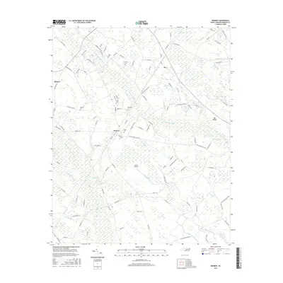
2016 Map of Rennert
USGS Topo · Published 2016About this map
Big Marsh Swamp and Tenmile Swamp dominate the low-lying drainage patterns of Robeson County, defining the agricultural and residential layout of this North Carolina landscape. Small rural communities like Rennert and Rex are connected by a network of local roads such as Rennert Rd and Shannon Rd, which navigate around expansive basins labeled as The Desert, Great Desert, and Blue Desert. These names suggest a historical character of the terrain that contrasts with the surrounding wetlands and bays like Panther Bay and Sewell Bay.
Find a feature on this map
115 named features on this map. Tap any name to fly to it.
Don’t see what you’re looking for? This feature index may not catch every label — zoom into the map to look around manually.
Map Details
Editions of this 2016 Rennert Map
This is the sole edition of this map. No revisions or reprints were ever made.
Other maps of this area

1953 · Florence
USGS Topo · 1:250,000

1954 · Florence
USGS Topo · 1:250,000

1957 · Bladenboro
USGS Topo · 1:62,500

1959 · Saint Pauls
USGS Topo · 1:62,500

1972 · Northwest Lumberton
USGS Topo · 1:24,000

1972 · Rennert
USGS Topo · 1:24,000
1972 · Raeford
USGS Topo · 1:24,000

1972 · Pembroke
USGS Topo · 1:24,000
1972 · Parkton
USGS Topo · 1:24,000
1974 · Red Springs
USGS Topo · 1:24,000