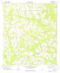
1974 Map of Reno
USGS Topo · Published 1976About this map
Nickleville and the surrounding rural communities of Grady County appear here during the mid-1970s, characterized by a dense network of country churches and family cemeteries. The landscape is defined by the branching tributaries of Tired Creek and Wolf Creek, where small settlements like Reno and Princes Still are connected by a web of light-duty and unimproved roads.
Find a feature on this map
29 named features on this map. Tap any name to fly to it.
Don’t see what you’re looking for? This feature index may not catch every label — zoom into the map to look around manually.
Map Details
Editions of this 1974 Reno Map
This is the sole edition of this map. No revisions or reprints were ever made.
Other maps of this area

1954 · Tallahassee
USGS Topo · 1:250,000

1955 · Whigham
USGS Topo · 1:62,500

1956 · Havana North
USGS Topo · 1:24,000

1956 · Cairo
USGS Topo · 1:62,500

1956 · Calvary
USGS Topo · 1:24,000

1957 · Beachton
USGS Topo · 1:24,000

1959 · Tallahassee
USGS Topo · 1:250,000

1960 · Tallahassee
USGS Topo · 1:250,000
1974 · Whigham
USGS Topo · 1:24,000
1974 · Climax North
USGS Topo · 1:24,000