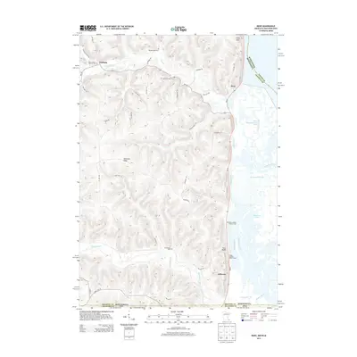
2013 Map of Reno
USGS Topo · Published 2013About this map
The Wisconsin-Minnesota and Minnesota-Iowa border regions converge here along the complex riparian landscape of the Mississippi River valley. The settlement of Reno sits tucked against the bluffs, while Freeburg and Jefferson occupy higher ground above the intricate network of the Minnesota Slough and Bluff Slough. This modern survey documents the persistent rural character of Houston and Allamakee counties, where narrow valleys like those of Crooked Creek and Winnebago Creek have dictated the placement of roads and homesteads for generations. Genealogists can identify several key burial grounds including the Saint Nicholas Catholic Cem and Old Methodist Cem. The area is defined by its transition from the steep upland terrain of Jefferson Ridge and Twin Bluffs to the expansive wetlands of the Reno Bottoms Canoe Trail, punctuated by landmarks like Fairy Rock.
Find a feature on this map
45 named features on this map. Tap any name to fly to it.
Don’t see what you’re looking for? This feature index may not catch every label — zoom into the map to look around manually.
Map Details
Editions of this 2013 Reno Map
This is the sole edition of this map. No revisions or reprints were ever made.
Other maps of this area

1903 · Waukon
USGS Topo · 1:125,000

1926 · Stoddard
USGS Topo · 1:62,500

1929 · Ferryville
USGS Topo · 1:62,500

1932 · Ferryville
USGS Topo · 1:62,500

1956 · Brownsville
USGS Topo · 1:62,500

1958 · La Crosse
USGS Topo · 1:250,000

1961 · La Crosse
USGS Topo · 1:250,000

1965 · La Crosse
USGS Topo · 1:250,000
1965 · Stoddard
USGS Topo · 1:62,500

1966 · Ferryville
USGS Topo · 1:62,500