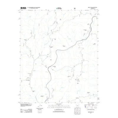
2011 Map of Reno Pass
USGS Topo · Published 2011About this map
Mount Ord stands as a dominant vertical landmark in this high-desert landscape, crowned by the Mount Ord Lookout Tower which offers a vantage over the surrounding complex of peaks and canyons. The drainage network of Sycamore Creek and its various forks, including the West Fork Sycamore Creek and East Fork Sycamore Creek, carves through the terrain, supporting numerous water sources like Sycamore Spring and Rock Spring. Human activity is concentrated along the north-south transit corridor, evidenced by the Arizona Highway Maintenance Beeline Yard and the Cross F Ranch. The presence of the Cross F Trailhead indicates the area's transition into a space for managed recreation. To the south, Sunflower Valley sits at the base of Arrowhead Mountain, while the namesake Reno Pass provides a crossing point near Eagle Peak. Numerous named seeps and springs, such as Whiskey Spring and Kitty Joe Spring, highlight the critical role of water in this arid Arizona environment.
Find a feature on this map
47 named features on this map. Tap any name to fly to it.
Don’t see what you’re looking for? This feature index may not catch every label — zoom into the map to look around manually.
Map Details
Editions of this 2011 Reno Pass Map
This is the sole edition of this map. No revisions or reprints were ever made.
Other maps of this area

1887 · Verde
USGS Topo · 1:250,000

1892 · Verde
USGS Topo · 1:250,000

1907 · Roosevelt
USGS Topo · 1:125,000

1909 · Four Peaks
USGS Topo · 1:125,000

1912 · Roosevelt
USGS Topo · 1:125,000

1929 · Turret Peak
USGS Topo · 1:125,000

1930 · Cave Creek
USGS Topo · 1:125,000

1933 · Turret Peak
USGS Topo · 1:125,000

1936 · Payson
USGS Topo · 1:48,000

1939 · Cave Creek
USGS Topo · 1:125,000