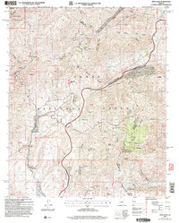
2004 Map of Reno Pass
USGS Topo · Published 2006About this map
Mazatzal Wilderness and the Tonto National Forest dominate this landscape along the boundary of Maricopa and Gila counties. The terrain is marked by significant geological and industrial features, including the Iron Dike and the Slate Creek Divide. Mining history is evident through the presence of the Ord Mine, Cornucopia Mine, and numerous unnamed prospect sites scattered across the ridges.
Find a feature on this map
47 named features on this map. Tap any name to fly to it.
Don’t see what you’re looking for? This feature index may not catch every label — zoom into the map to look around manually.
Map Details
Editions of this 2004 Reno Pass Map
This is the sole edition of this map. No revisions or reprints were ever made.
Other maps of this area

1887 · Verde
USGS Topo · 1:250,000

1892 · Verde
USGS Topo · 1:250,000

1907 · Roosevelt
USGS Topo · 1:125,000

1909 · Four Peaks
USGS Topo · 1:125,000

1912 · Roosevelt
USGS Topo · 1:125,000

1929 · Turret Peak
USGS Topo · 1:125,000

1930 · Cave Creek
USGS Topo · 1:125,000

1933 · Turret Peak
USGS Topo · 1:125,000

1936 · Payson
USGS Topo · 1:48,000

1939 · Cave Creek
USGS Topo · 1:125,000