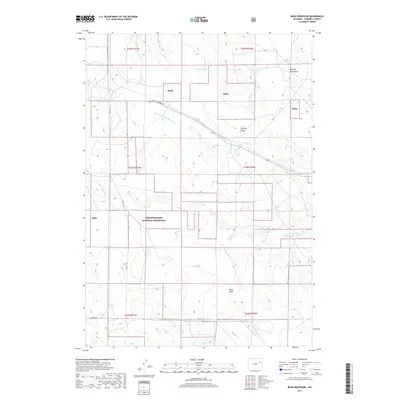
2017 Map of Reno Reservoir
USGS Topo · Published 2017About this map
Thunder Basin National Grassland dominates this portion of the Powder River Basin in Campbell County, where the high plains terrain is defined by an intricate network of seasonal watercourses and draws. The drainage pattern of Little Thunder Cr and its various tributaries, including the N Prong Little Thunder Cr and Dry Fork Little Thunder Cr, illustrates the hydrologic character of this grazing land. At the heart of this landscape lies the Reno Reservoir, a critical water resource for the region's ranching operations. The survey captures a sparsely settled area where life is organized around section lines and a few key corridors like Hilight Rd and Little Thunder Rd. Prominent local landmarks such as Burning Coal Draw and Shipley Draw provide essential orientation in this expansive prairie environment.
Find a feature on this map
20 named features on this map. Tap any name to fly to it.
Don’t see what you’re looking for? This feature index may not catch every label — zoom into the map to look around manually.
Map Details
Editions of this 2017 Reno Reservoir Map
This is the sole edition of this map. No revisions or reprints were ever made.
Other maps of this area

1955 · Newcastle
USGS Topo · 1:250,000

1958 · Newcastle
USGS Topo · 1:250,000

1971 · Teckla
USGS Topo · 1:24,000

1971 · Open A Ranch
USGS Topo · 1:24,000

1971 · Reno Junction
USGS Topo · 1:24,000

1971 · Reno Reservoir
USGS Topo · 1:24,000

1971 · Piney Canyon SW
USGS Topo · 1:24,000

1971 · Piney Canyon NW
USGS Topo · 1:24,000

1971 · Little Thunder Reservoir
USGS Topo · 1:24,000

1971 · Teckla SW
USGS Topo · 1:24,000