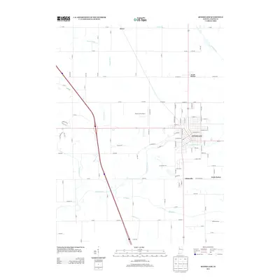
2013 Map of Rensselaer
USGS Topo · Published 2013About this map
Rensselaer serves as the focal point of this Northwest Indiana landscape, where the Iroquois River winds through the heart of town. The area exhibits a transition from the urban grid of the county seat to the expansive agricultural drainage networks that define Jasper County. The map details the proximity of Collegeville to the south and the outlying settlements of North Marion and South Marion, which grew along the primary north-south corridor.
Find a feature on this map
97 named features on this map. Tap any name to fly to it.
Don’t see what you’re looking for? This feature index may not catch every label — zoom into the map to look around manually.
Map Details
Editions of this 2013 Rensselaer Map
This is the sole edition of this map. No revisions or reprints were ever made.
Other maps of this area

1953 · Chicago
USGS Topo · 1:250,000

1953 · Danville
USGS Topo · 1:250,000

1955 · Danville
USGS Topo · 1:250,000

1956 · Danville
USGS Topo · 1:250,000

1957 · Chicago
USGS Topo · 1:250,000

1961 · Mount Ayr
USGS Topo · 1:24,000

1962 · Gifford
USGS Topo · 1:24,000

1962 · Parr
USGS Topo · 1:24,000

1962 · Goodland
USGS Topo · 1:24,000
1962 · Fair Oaks
USGS Topo · 1:24,000