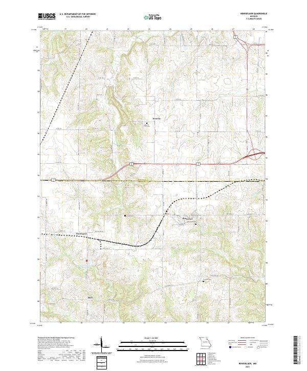
2021 Map of Rensselaer
USGS Topo · Published 2021About this map
Rensselaer and the surrounding farm country of Ralls and Marion Counties appear here in a landscape defined by small settlements and family-named cemeteries. This agricultural region is punctuated by the village of West Ely and its namesake West Ely Graveyard, alongside other historic burial sites like Finley Cem and Foreman Cem. The terrain follows a series of ridges and creek beds, most notably Walnut Ridge and the winding course of Lick Cr.
Find a feature on this map
68 named features on this map. Tap any name to fly to it.
Don’t see what you’re looking for? This feature index may not catch every label — zoom into the map to look around manually.
Map Details
Editions of this 2021 Rensselaer Map
This is the sole edition of this map. No revisions or reprints were ever made.
Other maps of this area

1903 · Palmyra
USGS Topo · 1:125,000

1925 · Quincy
USGS Topo · 1:62,500

1932 · Hannibal
USGS Topo · 1:62,500

1936 · Hannibal
USGS Topo · 1:48,000

1944 · Quincy
USGS Topo · 1:62,500

1945 · Hannibal
USGS Topo · 1:62,500

1945 · Quincy
USGS Topo · 1:62,500

1948 · Quincy
USGS Topo · 1:250,000

1949 · Palmyra
USGS Topo · 1:24,000

1949 · Philadelphia
USGS Topo · 1:24,000