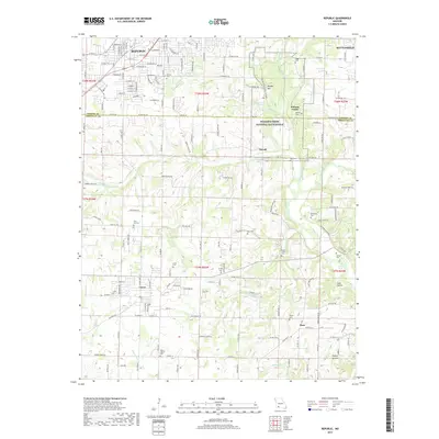
2017 Map of Republic
USGS Topo · Published 2017About this map
Wilson's Creek National Battlefield dominates the eastern half of this terrain, preserving the site of significant Civil War conflict along the banks of Wilsons Creek. The landscape transitions from the suburban grids of Republic and the growing community of Battlefield into a rural expanse marked by numerous family cemeteries and rugged hollows. The presence of historic sites like Bloody Hill and several early burial grounds, including Turner Cem and Wise Hill Cem, provides a clear view of the area's deep-rooted settlement history. Toward the south, the winding James River and its tributary Green Valley Creek carve through the topography near Boaz, where landmarks like the Blue Hole and Cave Hollow characterize the region's unique karst-influenced hydrology. This 2017 survey reflects the modern intersection of rapid residential expansion and carefully preserved historical grounds.
Find a feature on this map
102 named features on this map. Tap any name to fly to it.
Don’t see what you’re looking for? This feature index may not catch every label — zoom into the map to look around manually.
Map Details
Editions of this 2017 Republic Map
This is the sole edition of this map. No revisions or reprints were ever made.
Other maps of this area

1884 · Springfield
USGS Topo · 1:125,000

1886 · Greenfield
USGS Topo · 1:125,000

1886 · Springfield
USGS Topo · 1:125,000

1888 · Greenfield
USGS Topo · 1:125,000

1907 · Forsyth
USGS Topo · 1:125,000

1919 · Halltown
USGS Topo · 1:62,500

1935 · Springfield
USGS Topo · 1:24,000

1936 · Brookline
USGS Topo · 1:24,000

1942 · Aurora
USGS Topo · 1:62,500

1945 · Harrison
USGS Topo · 1:250,000