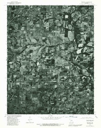
1979 Map of Republic
USGS Topo · Published 1981About this map
Republic sits at the northern edge of this southwestern Missouri orthophoto, where residential grids meet the expanding agricultural landscape of Greene County. Prepared from aerial imagery captured in late 1979, the map reveals the distinct transition from the concentrated settlement at Republic to the rural communities of Clever and Boaz further south. The landscape is defined by a dense mosaic of rectangular pastures and woodlots, a pattern shaped by the 1960 land line data overlaid onto this photographic record. Hydrological features such as Wilsons Creek and the James River meander through the eastern and southern portions of the quadrangle, their wooded banks contrasting sharply with the cleared farmland that dominates the region. This orthophotoquad serves as a precise visual baseline for understanding the rural development and land use patterns of the area at the close of the 1970s.
Find a feature on this map
5 named features on this map. Tap any name to fly to it.
Don’t see what you’re looking for? This feature index may not catch every label — zoom into the map to look around manually.
Map Details
Editions of this 1979 Republic Map
This is the sole edition of this map. No revisions or reprints were ever made.
Other maps of this area

1884 · Springfield
USGS Topo · 1:125,000

1886 · Greenfield
USGS Topo · 1:125,000

1886 · Springfield
USGS Topo · 1:125,000

1888 · Greenfield
USGS Topo · 1:125,000

1907 · Forsyth
USGS Topo · 1:125,000

1919 · Halltown
USGS Topo · 1:62,500

1935 · Springfield
USGS Topo · 1:24,000

1936 · Brookline
USGS Topo · 1:24,000

1942 · Aurora
USGS Topo · 1:62,500

1945 · Harrison
USGS Topo · 1:250,000