
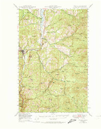
1948 Map of Republic
USGS Topo · Published 1957About this map
Republic serves as the focal point for this mountain landscape in northeastern Washington, captured just after the post-war period. The town sits at the intersection of State 4 and State 21, surrounded by the high peaks of the Colville National Forest. The local economy of the late 1940s is reflected in the presence of the California Mine and the Great Northern railroad line, which follows the drainage of Curlew Lake southward through Pollard and Torboy.
Find a feature on this map
55 named features on this map. Tap any name to fly to it.
Don’t see what you’re looking for? This feature index may not catch every label — zoom into the map to look around manually.
Map Details
Editions of this 1948 Republic Map
2 editions found
Other maps of this area

1904 · Republic
USGS Topo · 1:125,000

1936 · Marcus
USGS Topo · 1:96,000

1942 · Marcus
USGS Topo · 1:125,000

1948 · Curlew
USGS Topo · 1:62,500

1948 · Sherman Peak
USGS Topo · 1:62,500

1948 · Togo Mountain
USGS Topo · 1:62,500

1951 · Wauconda
USGS Topo · 1:62,500

1951 · Togo Mountain
USGS Topo · 1:62,500

1951 · Sherman Peak
USGS Topo · 1:62,500

1951 · Curlew
USGS Topo · 1:62,500