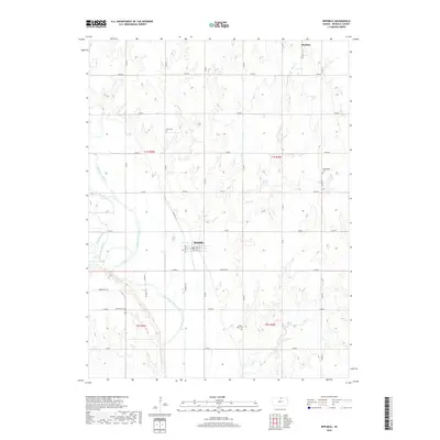
2018 Map of Republic
USGS Topo · Published 2018About this map
The Republican River winds through the western portion of this Republic County landscape, defining the topography of the region near the Nebraska border. The town of Republic serves as the central hub, oriented around Main St and South St, while the small settlement of Harbine sits at the northern edge. The area is characterized by a dense grid of section roads and several notable waterways, including White Rock Creek and Otter Cr.
Find a feature on this map
40 named features on this map. Tap any name to fly to it.
Don’t see what you’re looking for? This feature index may not catch every label — zoom into the map to look around manually.
Map Details
Editions of this 2018 Republic Map
This is the sole edition of this map. No revisions or reprints were ever made.
Other maps of this area

1892 · Concordia
USGS Topo · 1:125,000

1898 · Hebron
USGS Topo · 1:125,000

1955 · Manhattan
USGS Topo · 1:250,000

1955 · Lincoln
USGS Topo · 1:250,000

1956 · Manhattan
USGS Topo · 1:250,000

1957 · Manhattan
USGS Topo · 1:250,000

1957 · Lincoln
USGS Topo · 1:250,000

1958 · Lincoln
USGS Topo · 1:250,000

1960 · Byron
USGS Topo · 1:24,000
1960 · Hebron SW
USGS Topo · 1:24,000