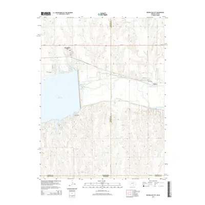
2014 Map of Republican City
USGS Topo · Published 2014About this map
Republican City stands on the northern banks of the expansive Harlan County Lake, a centerpiece of this southern Nebraska landscape. The lake dominates the western portion of the map, featuring recreational and geographic landmarks such as Patterson Harbor, Gremlin Cove, and the prominent Cedar Point. To the east, the Republican River continues its course, flanked by an intricate irrigation network including the Franklin Canal and Naponee Canal, which underscore the agricultural importance of the valley.
Find a feature on this map
43 named features on this map. Tap any name to fly to it.
Don’t see what you’re looking for? This feature index may not catch every label — zoom into the map to look around manually.
Map Details
Editions of this 2014 Republican City Map
This is the sole edition of this map. No revisions or reprints were ever made.
Other maps of this area

1893 · Phillipsburg
USGS Topo · 1:125,000

1896 · Holdrege
USGS Topo · 1:125,000

1955 · Grand Island
USGS Topo · 1:250,000

1955 · Beloit
USGS Topo · 1:250,000

1957 · Grand Island
USGS Topo · 1:250,000

1958 · Grand Island
USGS Topo · 1:250,000

1959 · Beloit
USGS Topo · 1:250,000

1973 · Kensington NE
USGS Topo · 1:24,000

1973 · Stuttgart NE
USGS Topo · 1:24,000
1973 · Kensington NW
USGS Topo · 1:24,000
Featured Places
- Republican City, NE
- Naponee, NE
- Taylor Manor Trailer Court, Republican City
- Phillips County, KS
- Harlan County, NE