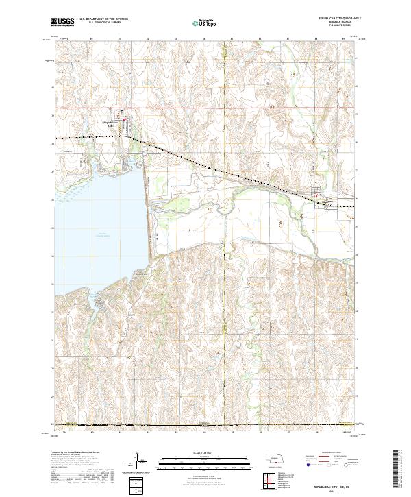
2021 Map of Republican City
USGS Topo · Published 2021About this map
Harlan County Lake dominates this central Nebraska landscape, a massive reservoir that transformed the valley of the Republican River. The village of Republican City sits on the northern shore, where a grid of streets like Second St and Truman Ave meet the water's edge at Gremlin Cove. To the east, the village of Naponee is positioned near the Franklin Canal, reflecting the region's reliance on managed water systems for agriculture. The map detail shows a complex network of county roads, such as Reservoir Rd and the Franklin Harlan Rd, which bridge the boundary between Harlan and Franklin counties. South of the main lake, Patterson Harbor and the overlook at Cedar Point mark the transition from the aquatic recreation areas to the dissected plains. The southern margin reaches the Nebraska Kansas state line, illustrating the remote borderlands where Crow Cr winds through the hills.
Find a feature on this map
60 named features on this map. Tap any name to fly to it.
Don’t see what you’re looking for? This feature index may not catch every label — zoom into the map to look around manually.
Map Details
Editions of this 2021 Republican City Map
This is the sole edition of this map. No revisions or reprints were ever made.
Other maps of this area

1893 · Phillipsburg
USGS Topo · 1:125,000

1896 · Holdrege
USGS Topo · 1:125,000

1955 · Grand Island
USGS Topo · 1:250,000

1955 · Beloit
USGS Topo · 1:250,000

1957 · Grand Island
USGS Topo · 1:250,000

1958 · Grand Island
USGS Topo · 1:250,000

1959 · Beloit
USGS Topo · 1:250,000

1973 · Kensington NE
USGS Topo · 1:24,000

1973 · Stuttgart NE
USGS Topo · 1:24,000
1973 · Kensington NW
USGS Topo · 1:24,000
Featured Places
- Republican City, NE
- Naponee, NE
- Taylor Manor Trailer Court, Republican City
- Phillips County, KS
- Franklin County, NE