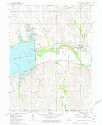
1974 Map of Republican City
USGS Topo · Published 1977About this map
Harlan County Lake dominates the western landscape of this mid-1970s survey, its waters covering historical terrain once defined by the Republican River. The engineering of the valley is evident through a complex network of canals and siphons that manage water flow east of the dam. The settlement of Republican City is positioned near the Burlington Northern line, serving as a local hub alongside the Republican City Municipal Airport.
Find a feature on this map
30 named features on this map. Tap any name to fly to it.
Don’t see what you’re looking for? This feature index may not catch every label — zoom into the map to look around manually.
Map Details
Editions of this 1974 Republican City Map
This is the sole edition of this map. No revisions or reprints were ever made.
Other maps of this area

1893 · Phillipsburg
USGS Topo · 1:125,000

1896 · Holdrege
USGS Topo · 1:125,000

1955 · Grand Island
USGS Topo · 1:250,000

1955 · Beloit
USGS Topo · 1:250,000

1957 · Grand Island
USGS Topo · 1:250,000

1958 · Grand Island
USGS Topo · 1:250,000

1959 · Beloit
USGS Topo · 1:250,000

1973 · Kensington NE
USGS Topo · 1:24,000

1973 · Stuttgart NE
USGS Topo · 1:24,000
1973 · Kensington NW
USGS Topo · 1:24,000
Featured Places
- Republican City, NE
- Naponee, NE
- Taylor Manor Trailer Court, Republican City
- Phillips County, KS
- Franklin County, NE